Green Infrastructure Model and Strategy
When people talk about infrastructure, they’re most often discussing highways, energy sources, and buildings. But there is more to it. Just as planners design networks of roads, organizations can design networks of open spaces and natural resources that connect communities and regions. The latter is what we call a “green infrastructure.” Learn more »
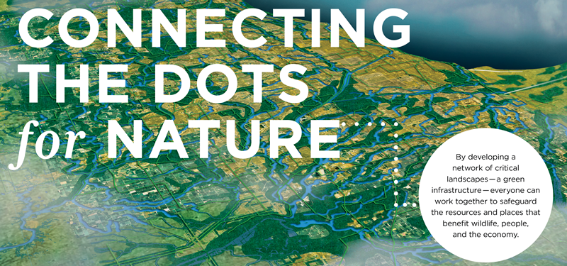
Green infrastructure has emerged as a term referring to a strategically planned and managed network of natural lands, working landscapes, and other open spaces that conserves ecosystem functions and provides associated benefits to human populations. In collaboration with local partners, including Citizens for Conservation and Lake Forest Open Lands Association, we have developed a mapping tool to identify interconnected systems of landscapes to preserve natural habitats and protect biodiversity. It will also help guide regional and local planning by agencies, corporations, and citizens of Lake County. This geographic information system (GIS) based model provides visual representation and guidance as we work toward our 100-year Vision for Lake County, including an assessment of:
-
Potential large-scale woodland, wetland, and prairie wildlife habitat areas
-
10,000-acre ecological complexes in and around Lake County
-
Water resource capabilities and groundwater recharge areas
-
Lake Michigan ravine and lake plain habitat protection
-
Ecosystem services valuation in Lake County

The Lake County Green Infrastructure Model and Strategy uses landscapes as the primary organizing principle and was developed using a core-hub-corridor approach. Learn more »
Landscapes are a mosaic of ecosystems or land uses that possess common attributes, repeated across a large area. Landscapes provide the rationale for deciding which resources to include and connect within a green infrastructure network. Interconnected landscapes are resilient to change, enabling migration of species, genetic exchange, and adaptation.

It is a framework of the major landscape types in the county that will be used to identify conservation, recreation, and restoration opportunities.
 |
 |
 |
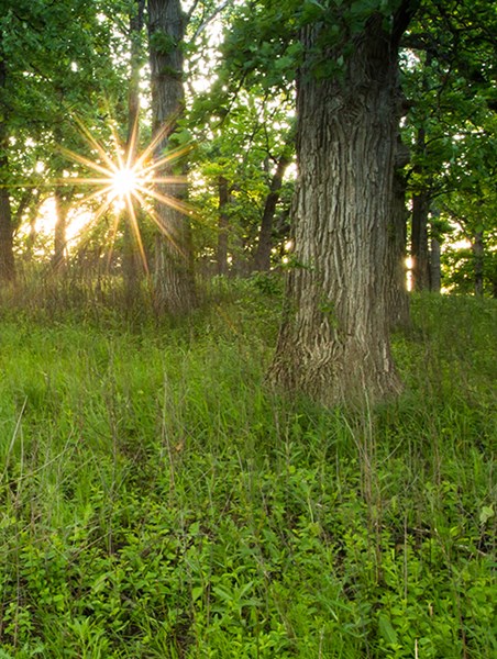
Woodland and Forest Ecosystems Learn more »
Woodland/forest communities include landscapes dominated by trees with an average canopy cover of greater than 50 percent. These ecosystems once dominated much of Lake County. Within this class there are four community types: upland forest, floodplain forest, flatwoods, and woodlands. Of the forested communities, woodlands are of the highest conservation concern. Regionally, 17 percent of the original oak ecosystems remain, and these communities are highly variable across the region.
There are an estimated 25,000 acres that could be restored to woodland/forest in Lake County.
|
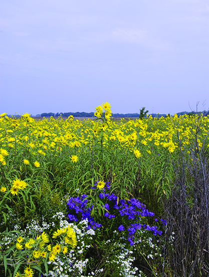
Prairie, Savanna, and Grassland Ecosystems Learn more »
Prairies and grasslands are both communities dominated by grasses on organic or mineral soils. Prairies once dominated the southern part of Lake County but now exist in small, isolated remnants. Some prairie types are considered globally imperiled. Savannas are wooded communities with a grassy ground cover and an average tree canopy of 10–50 percent. Savannas contain distinct plants and animals. Due to their degraded condition and global conservation significance, savannas are one of the highest priorities for conservation in the region.
There are an estimated 23,000 acres that could be restored to prairie/savanna/grassland in Lake County.
|
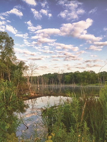
Wetland Ecosystems Learn more »
The Chicago region has one of the most diverse collections of wetlands in North America, including a Ramsar Wetland of International Importance that contains Spring Bluff Forest Preserve (Winthrop Harbor). Wetlands are communities that are inundated or saturated by surface or groundwater for a large part of the year and support vegetation that is adapted to life in wet soil. Their vegetation, the amount of water they hold, and the chemistry of their soil and water define the different wetland types and functions.
There are an estimated 59,000 acres that could be restored to wetland habitat in Lake County.
|
Making the Values of Nature Visible
Ecosystem services are the collective benefits from an array of resources and processes that are supplied by nature. Forests, wetlands, prairies, water bodies, and other natural ecosystems support human existence. Only recently has it become possible to quantify and reliably estimate the contributions that green infrastructure makes available to human well-being, and to measure the benefits that nature provides us for free.
Balancing green and gray infrastructure develops sustainable communities. By creating a green infrastructure strategy, communities work together to preserve and connect open spaces, watersheds, wildlife habitat, forest preserves, and other critical landscapes. Find out more about this strategy through our interactive story maps.
Find more information in the Executive Summary, the full report below, or download the Green Infrastructure Model and Strategy GIS Data in zipped file format. The download will start immediately and is hosted by the Lake County GIS Division.
Download file »